HISTORICAL maps of Wrecclesham have been unveiled in the village as part of an initiative by the Wrecclesham History Project.
The detailed maps illustrate the many historical buildings in the village, as well as identifying and describing various features, and took one of the project’s members, Peter Watkins, around two years to complete the drawings.
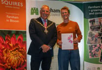
On completion, Peter gifted the map to the Wrecclesham History Project, of which he has been a supporter of since its foundation four years ago.
The members of the project then agreed that it should be displayed within the village to provide information about its past.
Wrecclesham History Project arranged for the map to be enlarged and displayed on two sites in the village; one in The Street, Wrecclesham, on the wall that fronts the Knights Alms-houses and the other in the new bus shelter on Shortheath Corner, at the top of School Hill.
Farnham Town Council paid for the map display boards, which were produced by Signs Express of Farnborough.
Peter has lived in his present house, previously his father’s house, in School Hill all his life.
He was educated at St Peter’s School in Wrecclesham, before making his way to Farnham Grammar School.
On leaving school he began a long period in local government, firstly with Farnham Town Council and, in 1974, at the time of local government reorganisation he was transferred to Waverley District Council, working from Godalming. He has been retired now for several years.
Peter is said to be well known around the village as he walks everywhere and is a keen amateur artist and draughtsman.


Comments
This article has no comments yet. Be the first to leave a comment.